This past weekend I ran The Great New York 100 Mile Running Expedition.
tl;dr: I reached 100 miles in 29:55, but missed the 100k cutoff so my finish is unofficial.
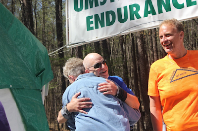
My early optimism was diminishing as the forecast deteriorated in the week prior to the race, culminating in a 90F+ degree day. But I never considered not showing up at all. My umstead DNF in March was weighing heavily on me (no pun intended) and I addressed it by going on a liquid only diet, for which I am now carrying around about 20 fewer pounds: Not as much as I would have liked before TGNY, but a lot better than nothing.
Still, I was publicly positive and made plans as usual to hang out with friends during the race, particularly Oak and Mary. Oak was in the same starting wave as I (5:02) and Mary was 5:04. We planned to have her catch up to us in The Park and power through the race, "party barge" style.
So we were off, it was cool in the morning, and when we got to The Park we ran a continuous mile to get the streak out of the way and then proceeded with walking the uphills, running down, and run-walking flats. Mary soon caught us and then quickly dropped us on a downhill and was out of sight. Oak and I stuck together, in no rush, moving at a decent pace, averaging about 12 minutes per mile even with walk breaks. Once we got to the Hudson River Pathway I started jogging easily and continuously 2-3 miles all the way to the bridge. By the time we got there, Mary was only a few meters in front of us and we hiked up the hill together.
And so it was through the rest of Manhattan, all the way to the Bronx. This early in the race most of the fast runners in later waves had caught up and having not seen many of them since before covid, we chatted a bit and got caught up.
I've completed the 100 mile and 100k version of this race once each but paced people enough that I've done the entire course probably four or five times - so I knew it pretty well and could repeat it from memory. But there were big course changes this year - the pedestrian pathway for the Henry Hudson Bridge was now open, meaning we no longer had to cross Spuyten Duyvil Creek by going over to Broadway first. Instead, the course crosses the HHB and proceeds north along the Hudson River, crossing through the neighborhood of Riverdale and going through parks there which had a few miles of really nice singletrack trail. We went all the way north to the Westchester County line before turning east and towards Van Cortlandt Park.
The new route in Van Cortlandt is far more windy and technical than the old, and I would have a hard time remembering it. But soon we were back on familiar trails and back on the old course, until we weren't again. There are more Bronx changes in the Soundview section, and I have to say these changes are a massive improvement. Instead of doing an out-and-back in City Island (which I didn't mind at all), we instead follow the coastline on non-technical singletrack, maintained pathways and neighborhood streets, and it all was very nice. The course was a bit confusing at first but now that I've done it I think I can do it again from memory. By this point, Denise had joined us and the four of us were in a bit of a loose group. After Soundview Park, there is yet another course change, removing the worst part of the entire 100-mile course under the Bruckner Expressway and instead has us running down Southern Street which is parallel to the Bruckner and showed me a part of the city I was unfamiliar with and has many restaurants and bodegas for optional support.
It is also at this time that the heat is starting to bear down on us. Oak offered me an ice bandana and, while initially reluctant, I took it and holy hell that was nice to have. I think I owe my race to that ice bandana. I feel like that was the difference between clinical heat exhaustion and just a hot day. I knew to slow down and take it easy, but the sheer exposure was starting to take its toll. With all the significant course changes past us, we entered Queens and, in the hottest part of the day, dedicated every moment to being a little farther along than the last. Oak mentioned running and I said no, too hot. He immediately understood. Near LGA a neighborhood guy named Joe - a trail angel - set up a garden hose spraying heat-affected runners - and even offered ice and water to us. That guy is a hero. Shortly after dousing myself in the spray of his hose I was able to run pretty much non stop the next mile to the aid station at the World Fair Marina.
The heat was taking its toll on others too. We were starting to hear about people dropping. Mary dropped and Denise was taking care of foot issues in Astoria, leaving just Oak and I for the eastbound trek in Queens. The afternoon wore on and so did the heat. We walked all the way through Flushing and then Fort Totten and the Cross Island Parkway Bike Path. At a point here, Oak and I made a pact. We knew that the 100k cutoff at 9pm was slipping away - we agreed to continue self-supported and finish the course. A fistbump sealed the deal and we were relieved of the pressure to push to 100k by 9pm.
Before exiting the CIP path, Denise caught us and immediately agreed to join our pact. I more or less knew that the finish wouldn't be official so I really wasn't in the mood to kill myself to get to 100k faster and risk heat exhaustion or a late-race deathmarch. And, even though it didn't matter anymore, we still thought we could finish the entire course before the race ended at 11am. Oak's pacer met him at the aid station at Alley Pond Park, and Denise's met her at the aid right after Kissena Park. They worked on some issues again while Oak and I continued - by the time we reached Flushing Meadows, Denise and her Pacer were running. Both pacers were going to try to get us to 100k before the cutoff. But I knew the math - it was 3 or 4 miles away and we had just a few minutes to get there.
By now it was late evening and starting to cool off, and we're running the majority of the time. Due to a missed turn on their part we actually got ahead of Denise and her pacer and the pacer got news that the cutoff was delayed to 9:30pm. But it was 9:15 and the 100k line was still almost two miles away. We put in a decent effort but it didn't matter, arriving about five minutes late.
Officially, this was the end of the race. Dwight was running the aid station and he told us we were officially done by asking if we would continue for an unofficial finish. Yes, of course. He made sure we understood we'd have no aid. "We're going to be self supported." While taking care of stuff, changing shirts, swapping out gear, Dwight handed me a 100k finishers certificate. Thank you Dwight but I don't want that. Denise, having stomach issues, opted not to continue, so Oak and I headed off into the night, down through the Richmond Hill section of Queens. This two mile stretch, straight down 108th St, goes through a residential area with broken sidewalks, music playing loudly in houses, and plenty of marijuana. It also has a Popeye's that's open til the wee hours. We stopped and got dinner - a chicken sammich and fries - and continued down into Howard Beach. Since it's possible the 7-11 there is the last aid for 20 miles, we stopped again and fueled up. Continuing south, the Howard Beach aid station was indeed gone. Midnight clicked over on the way to the Rockaways and I started running, for the streak. We ran a mile and a half continuously before reaching the neighborhood of Broad Channel and then the bridge to Rockaway. The next aid station, at the boardwalk, was gone. We stopped for a moment there, aware that this - mile 71 - is the farthest point of the course from the starting line. From here we would turn west and head back to Times Square. It was 1am.
The Boardwalk at Rockaway is longer than it used to be, and we get to go farther before moving onto the street and running through the quiet neighborhood there in the middle of the night. Then we run through Riis park. The aid station here was gone. We then turn north off the barrier island over the Gil Hodges bridge into Brooklyn, then along the Belt Parkway into Sheepshead Bay. We arrived at the aid station there at 4am, it was just about to close. Also, other runners officially in the race were there! We left, no longer DFL (this didn't last - they passed us back two miles later.)
I tried to run a bit on the 1.5 mile long Coney Island Boardwalk but it was futile. It was now somewhat light out and I was hitting a wall. When we got to Cyclones Stadium I had to sit down and recover. I took some caffeine and Advil and started trudging along again. Oak and his pacer were looking for a bathroom, so they tucked into a diner and I continued down the trail, and the advil/caffeine worked and started jogging again, all the way to the next aid, which marks the beginning of the 4.5 mile long pathway under the Verrazano Bridge. I grabbed three slices of cold pizza from the aid and started walking. After wolfing them down I started jogging and kept it up all the way to the bridge - a distance of almost two miles - which is remarkable for me that late in a race. I took a walk break and then started running again - all the way to the end of the pathway, another mile and a half.
The penultimate aid station was still open and soon we were on Fourth Ave, a 3 mile stretch of sidewalks and traffic signals late in the race. Prior to the race, Oak was really jazzed to run TGNY and see the city. On Fourth Ave, I asked him, "have you seen enough of the city?" "Yes." 4th Ave is placed, as if strategically, to frustrate people who are ready to be done. It is an endless countdown of streets, from 66th to 1st, with numerous enticing delis and coffee shops to hold up your progress. Finally you pass 1st street and then cross the Gowanus Canal on a bridge that is probably the most rickety in the Five Boros before turning north on Court St and going through Carroll Gardens and Cobble Hill, which are neighborhoods best described as "you can't afford to live here."
I was doing ultra math and knew I had plenty of time to finish in under 30 hours, 22-23 minute miles would do it. I also was capable of running about 13 minutes per mile. I could walk 20 minutes per mile, but walking faster than that was aggravating my chafing and blister issues. I was tired and didn't feel like pushing it.
Oak and his pacer saw my walking pace, unable to keep up with their 17s and not running, and reckoned that I was giving up on a sub-30 finish. They went ahead and dropped me. Later Oak expressed regret but honestly it was the right thing for them to do. I arrived at the final aid station alone and, knowing I was the last runner, I just drank directly from a half empty water bottle to save time and got on the bridge.

It was starting to get hot out and the approach to the Brooklyn bridge is long and exposed but I still felt well enough to run down the other side of it and go up Centre Street, where I started my leisurely stroll up Manhattan. The only thing I made sure to do here was stay on the shady side of the street, because the sun was getting brutal. As I got into the numbered streets I was checking my watch repeatedly, making sure I had enough time. I discovered in the first mile of the race that Coros watches don't report an accurate pace in city settings with large buildings, so instead I was doing a street countdown against minutes remaining. I was staying ahead of schedule, getting stopped by the occasional red light. Finally I was in Herald Square with less than 15 minutes to go. I made it across 34th street, which is a real pain to get stuck at, and was frustrated by the lights north of there. I figured I was probably still ok, but just to be sure I jogged a few blocks, catching those lights, until I was at 40th with 5 minutes to get to 42nd. I knew at this point I'd be fine no matter what, so at 10:57 I strolled into a group of nervous looking friends and acquaintances at the finish line who remarked that I "came out of nowhere" to finish. I looked at my watch - and I had a bit over two minutes to spare. Perfect.
Phil was very nice, he shook my hand and congratulated me but then said he was sorry he couldn't give me a finisher's award because I missed the 100k cutoff. I immediately told him not to worry about it, it's all good - and it's not because I don't want to be "that guy" (although I don't want that either.) Besides the fact that I have enough buckles, I also have a tremendous amount of respect for Phil and his perspective on the situation is no doubt super complex and nuanced. But from my perspective, the explicit agreement when I left the 100k aid station was that I would be going for an unofficial finish. There is no expectation that I would get any award at all. I was grateful that he waited for me, many minutes after his last official finisher came in.
I will say that the distinction between an official and unofficial finish is meaningful only to certain people - but not to me and not to most of my friends. Of course I would prefer to have an official finish, but I do not regret one bit missing that cutoff. I ran the race I needed to run at the pace that I needed to finish under 30 hours, and from my perspective I executed it perfectly. So on the ultra list I include discussion of the distinction, but on social media I don't bother.
I am a bit overwhelmed at the tremendous outpouring of support from people - some that I disagree with ("he should have just given you a buckle!") and more that I agree with ("You’ve proved once again that the 100 miler is a race of persistence"), and some that just make me blush. ("The DNOF is one of the most impressive feats in ultra running.") Even in this year with terrible weather and COVID restrictions and the absence of Fred who couldn't make it, on balance it was a wonderful experience. I return to TGNY year after year because it is one of those special races and Phil is one of those special people. I'll always make room on my calendar to participate, one way or another.
Postscript. Oak, in from out of town, Remarked in mile two, "Central Park smells great!"
"Oak, I don't think that has ever been uttered by anybody ever in the history of New York."