Alex and Joe are leaving town for California next week; they'll be gone for about 18 days and I'll have some alone time for a while, including July 4th weekend.
To be sure, the majority of this alone-time is going to be normal routine for me. Wake up, go to work, go home, go to bed. Get a few runs in. Whatever. However, I decided to take advantage of the 3-day weekend and do something I feel like I've not done in a long time: a solo road-trip. (The last solo road-trip was to Chicago to run the marathon there in 2008.)
 |
| As of this writing, I've been to the highest point of 31 states. |
In my project to visit the highest point of as many states as I can, there are two left east of the Mississippi that I've not yet been to: Maine and Virginia. Ticking off both of those states is as good an excuse as any to get a road-trip in (really, do I need an excuse?), and right now I'm particularly interested in spending some time alone, on the road, and on a trail.
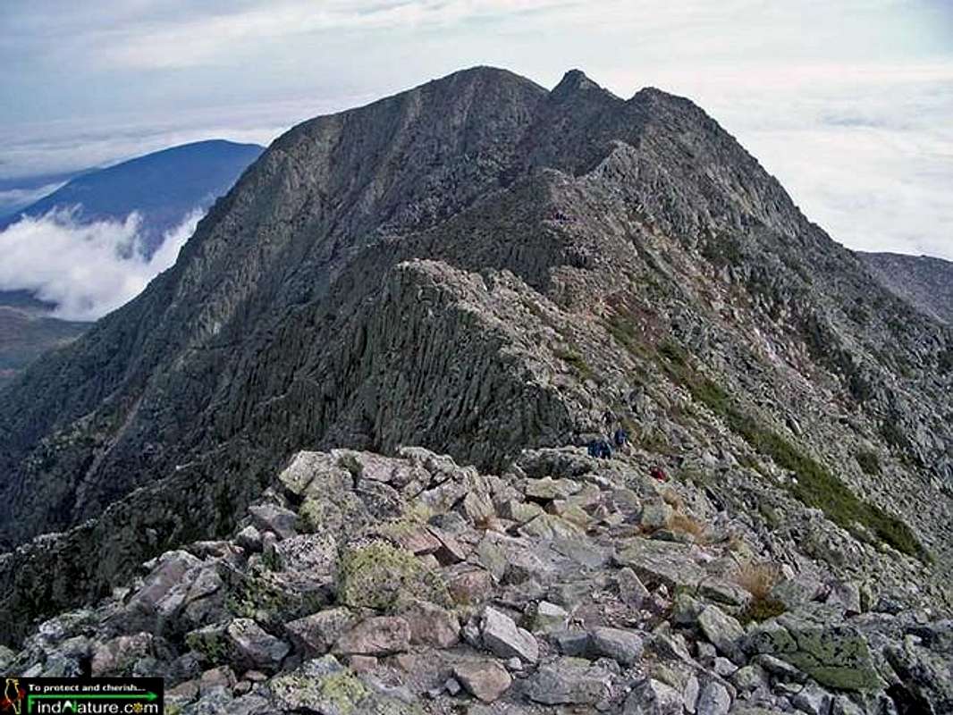 |
| Knife Edge, Mt. Katahdin, Maine. |
The first state I'll visit is Maine, where on July 3rd I have a reservation to park at Baxter State Park. I'll hike up Mt. Katahdin via the Knife Edge (weather permitting), a precipitous mile-long ridge between Pamola Peak and South Baxter Peak. As narrow as five feet with several-thousand-foot drop-offs on both sides, I've been wanting to climb the Knife Edge for years, both to satisfy my personal curiosity and to see if I can handle the exposure. Indeed, the Knife Edge is probably the closest you can get to big-mountain (Western USA) exposure without leaving the east coast.
 |
| Capitol Peak (CO) Knife Edge - Gnarlier than Mt. Katahdin Knife Edge |
After climbing Katahdin, I will probably make the very long drive from Maine to southwest Virginia to hike Mt. Rogers, a decidedly more mellow mountain.
 |
| Katahdin has moose, Mt. Rogers has... wild ponies? (yes, actually, it does.) |
Like I said, the drive to Mt. Rogers is long, but the hike is relatively easy: 8 miles round-trip with a couple thousand feet of climbing. No biggie. On the way, I'll likely come across members of a herd of wild ponies who live in the area. Indeed, the hard part about this highpoint, and the reason Virginia hasn't been ticked off has been completed, is the drive - nearly 600 miles from Suffern, and 1100 miles from Mt. Katahdin. Yes, if everything goes as planned (and that's a big if), I will drive over 2000 miles that weekend, by myself..
.. which should take care of the solo roadtrip bug for the at least the year or two.
New entries for Steve's blog are published on Mondays and Thursdays at 10:00am NY time
No comments:
Post a Comment